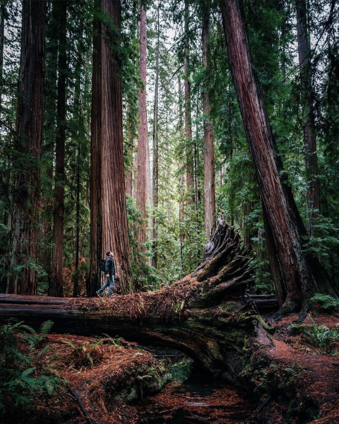
Photo Courtesy of giant-redwoods-california@tmack808
Hidden Hikes of Mendocino County
Mendocino County is a wonderland of world-class hikes – and many of them you’ll have recommended to you at your lodging, or will find in countless online guides. Here are a few of our favorite hikes that are lesser known – but equally magical!
Shady Dell on the Lost Coast
The Peter Douglas Trail is a 2.3-mile extension of the Lost Coast Trail that showcases ancient redwoods shaped like candelabras by wind and salty air. Instead of growing into massive straight columns, stressors caused these trees to sprout branches near the ground that droop like velvet ropes in a theater. Then when conditions improved, the branches grew straight up. Hikers will discover dramatic views, old-growth Douglas fir, majestic Roosevelt elk, and the tiny rare “secret pocket moss.” The trail is accessed from the south by taking Usal Road, off of Highway One. The dirt road is completely passable in dry weather. If adventurous, continue on to the primitive campsites in Sinkyone Wilderness State Park at Usal Beach Campground.
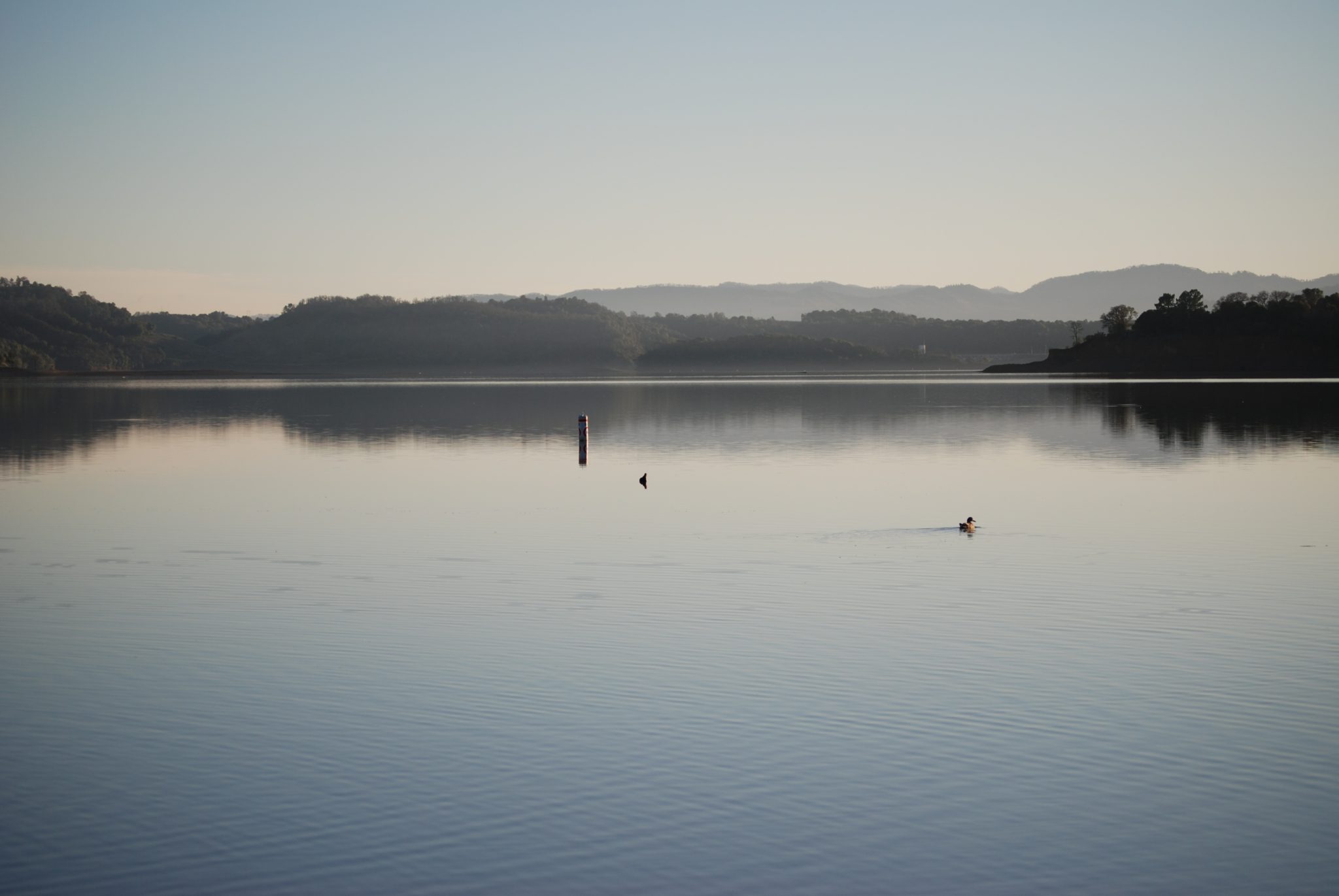
Lake Mendocino
The Shakota trail is a three mile mostly shaded walk that follows the western shore of the lake. Access the northern end of the trail by taking the Lake Mendocino exit off Hwy 20 east. Drive through the Kyen campground to the Pomo Cultural Center, where the trailhead is marked. To start at the southern end of Shakota trail, take Lake Mendocino Drive (exit off Hwy 101) towards Coyote Dam. Turn left when you see the sign for the overlook, park and watch for the trailhead just past the bathroom.
The 5 mile Eastside lake trail is accessed from Bushay Campground, which starts just east of the Hwy 20 bridge over the inlet to Lake Mendocino. The trailhead is at “Little Bear” campground. You can also access the trail from the south at the very end of Deerwood Road.
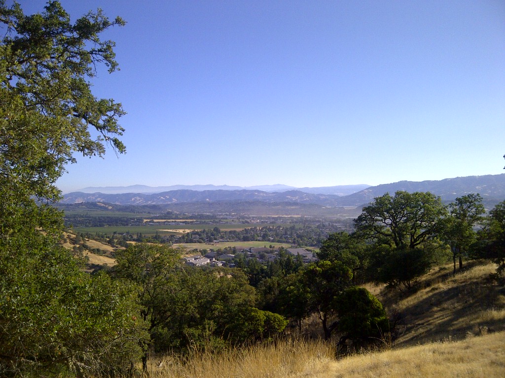
City View Trail in Ukiah
For a great view of the Ukiah Valley, drive out to Low Gap Park and hike up the City View Trail. Start at the parking lot across from the high school, take the paved road down hill and cross the wide bridge. Follow the road until it connects with a dirt road. Take the dirt road to the right and head up hill to the small trail that takes off left, marked with a “No Bikes” sign. Take this trail and immediately cross a little bridge and follow the trail as it proceeds up hill.
You will pass a vernal pool on the right of the trail. Look but don’t touch the vernal pool, as it is a very fragile and special environment. You will reach an intersection with Canyon Trail to the right, City View Trail to the left. The two mile loop trail goes up the hill for some great views. Combine it with “Canyon Trail” for a 4+ mile walk.
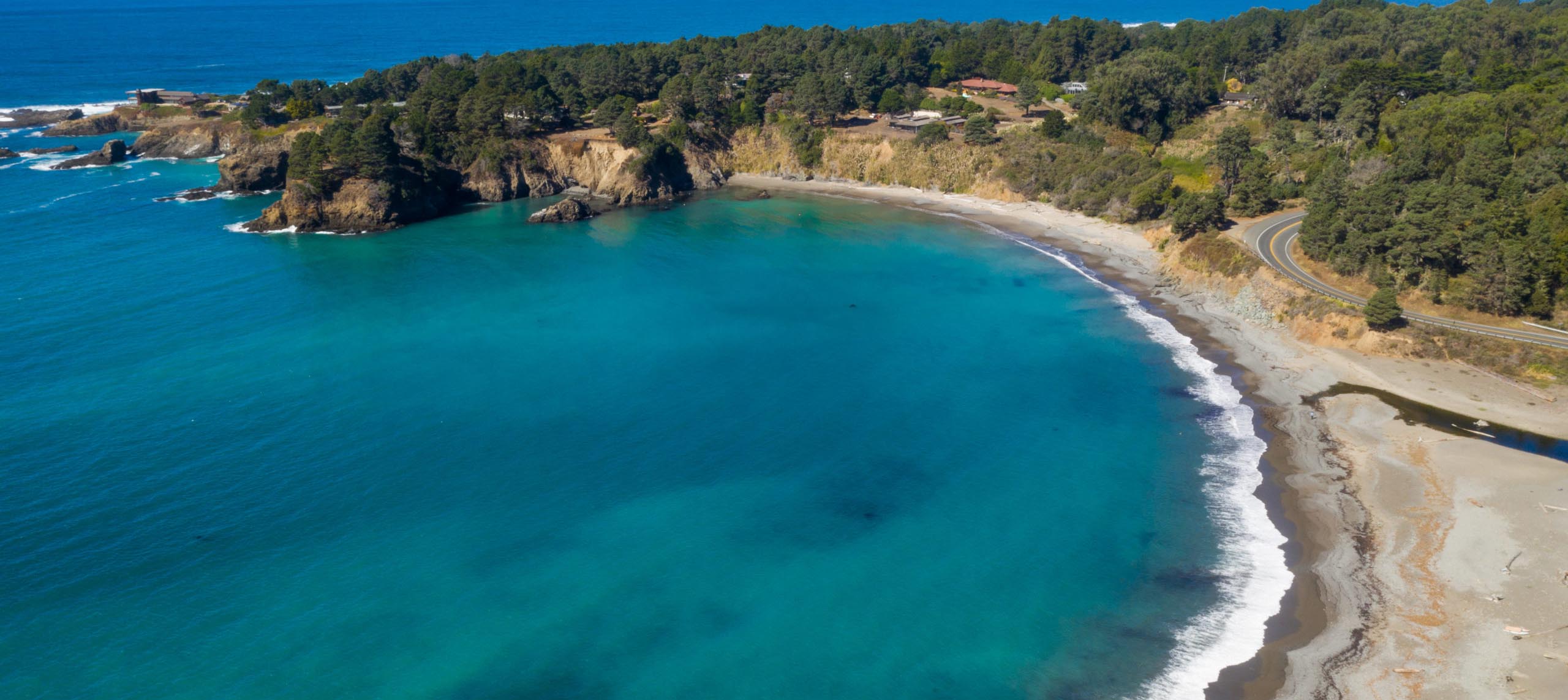
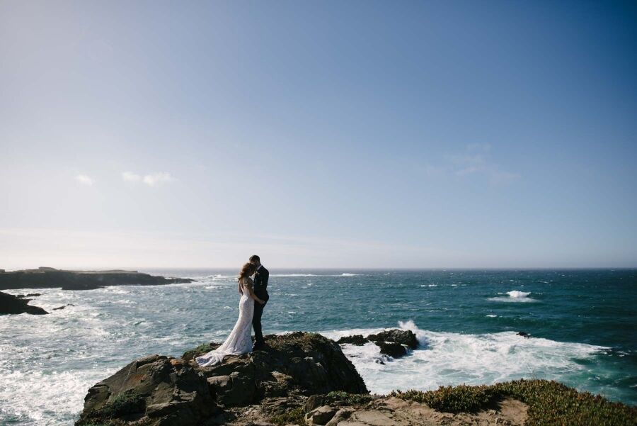
Spring Ranch Coastal Preserve
The latest addition to coastal hiking, the 300-acre Spring Ranch Preserve trail delivers picture postcard views of Mendocino, crashing waves, a blowhole, wildflowers, and whale watching. There are two entry points from Highway 1: just north of the Inn at Cobbler’s Walk (park on Peterson Lane), and directly across from Gordon Lane at M48.94. From either point hike down to the cliffs across the coastal prairie. The Village of Mendocino is to the north. A rather alarming blowhole is located near the southern end of the trail! There are a couple of benches where you can picnic, and watch the whales go by. Bring binoculars to spy the oyster catchers and cormorants diving from the rocks. In some areas, tidal pools are accessible. The trail is about 3 miles.
Photo Courtesy of giant-redwoods-california@tmack808
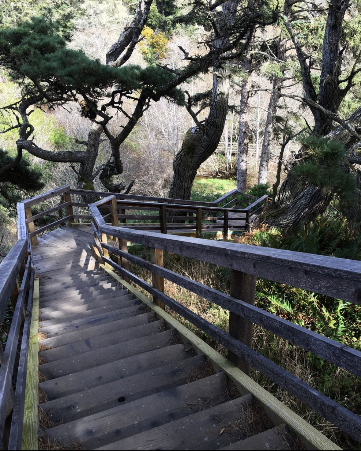
Montgomery Woods
Deep in the heart of the coastal range is this magnificent grove of old growth coast redwoods (Sequoia Sempervirens) that once contained the tallest known tree on the planet (its top was blown off by lightning)! The 2+ mile loop trail is best to visit in the afternoon when fewer visitors allow you to appreciate the serenity of the park and to enjoy the late-afternoon summer light. The reserve can be reached by taking Orr Springs Road west from Ukiah. Orr Springs Road starts just north of exit 549 and soon begins a steep climb and descent, then levels out and passes Orr Hot Springs, and enters a redwood forest. Look for a large wooden sign on your left. It’s about a 30 minute drive from Highway 101.
The reserve can also be reached by taking Comptche-Ukiah Road from the coast. After passing Comptche, follow the only paved road.
Combine your hike with a geology lesson on the Ecological Staircase Trail. Park at Jug Handle State Natural Reserve and follow the signs. The trail takes you on a tour of the geological updrift from the coast to the Pygmy Forest 2.5 miles inland. This marine terrace sequence is a textbook illustration of ecological succession. Each of the five terraces was uplifted from sea level about 100,000 years before the one below it, so as you walk from sea level to the Pygmy Forest, you are walking through half a million years of history. The terraces extend inland about 5 miles from the beach. Terraces 3, 4, and 5 contain some of the world’s oldest soils, depleted of nutrients and extremely acidic. Here is where Mendocino’s Pygmy Forests developed, adapted to this harsh environment.